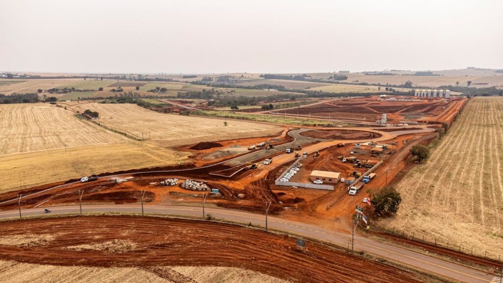
Cutting corners in land surveying can lead to costly mistakes, making accuracy the foundation of every successful project. Whether you’re establishing property boundaries, designing a new development, or mapping terrain, even the slightest miscalculation can result in legal disputes, construction errors, or financial losses. Precise measurements ensure that buildings, roads, and utilities are placed exactly where they need to be, preventing future complications.
The importance of accuracy in land surveying goes beyond just numbers—it protects investments and guarantees compliance with regulations. A well-executed survey safeguards property rights, minimizes risks, and supports seamless project execution. With advanced technology and rigorous verification processes, surveyors ensure that every data point is reliable, giving clients confidence in their land-related decisions.

Understanding the Challenges That Impact Surveying Accuracy
Achieving accuracy in land surveying is a complex process that requires more than just advanced technology. While modern tools have greatly improved precision, external factors such as environmental conditions and human error still pose significant challenges. From equipment calibration to unpredictable weather, surveyors must navigate multiple variables to ensure reliable results. Understanding these influencing factors is essential for improving surveying accuracy and avoiding costly mistakes in construction, property development, and infrastructure planning.
How Equipment Impacts Land Surveying Accuracy
The tools and technology used in land surveying play a crucial role in ensuring precise measurements. Advanced equipment like total stations and GPS devices are essential for modern surveying, but they are not immune to errors. Environmental factors such as temperature shifts can affect total stations, while GPS signals may be disrupted by atmospheric interference or signal obstructions, leading to inaccuracies in data collection.
Surveyors must regularly calibrate and maintain their equipment to minimize these errors and ensure optimal performance. Even with the best technology, external factors like electromagnetic interference and satellite positioning can create challenges. By understanding these potential issues, surveyors can take proactive measures to improve accuracy and reliability in their work.
External Factors That Can Compromise Surveying Precision
Beyond technology, natural and human elements also contribute to land surveying errors. Harsh weather conditions, such as heavy rain, snow, or strong winds, can make it difficult to obtain accurate measurements. Similarly, rugged terrain, dense forests, or tall structures can block sightlines and interfere with equipment, creating obstacles for surveyors in the field.
Human error is another major factor that can lead to miscalculations. Mistakes in data entry, incorrect instrument setup, or misinterpretation of readings can all result in inaccuracies. Proper training, attention to detail, and verification processes are essential in reducing these errors and ensuring the highest level of precision in land surveying.

Essential Strategies to Improve Land Surveying Accuracy
Achieving high accuracy in land surveying requires a combination of advanced technology, skilled expertise, and careful consideration of environmental factors. Modern surveying methods leverage GPS, total stations, and drone technology, but accuracy is also dependent on proper calibration, data verification, and cross-referencing multiple measurement techniques. Additionally, natural conditions such as weather, terrain, and visibility can significantly impact results, requiring surveyors to adapt their approach accordingly. By integrating best practices, maintaining strict quality control, and staying updated on industry advancements, surveyors can minimize errors and ensure reliable, precise measurements for any project.
Combining Survey Methods for Maximum Accuracy
One of the most effective ways to enhance land surveying accuracy is by using multiple measurement techniques. By integrating GPS with traditional methods like total stations and leveling, surveyors can cross-check data to reduce errors and inconsistencies. This approach not only increases precision but also provides a backup system in case one method is affected by external factors like signal interference or terrain challenges.
Cross-verifying measurements ensures that survey results are reliable and consistent. Modern technology allows surveyors to compare data from different sources, identifying discrepancies before they lead to costly mistakes. This layered approach enhances the credibility of survey findings and minimizes potential errors in property boundaries, infrastructure planning, and construction projects.
The Role of Training and Quality Control in Surveying Accuracy
Even with advanced tools, human expertise remains a critical factor in ensuring accurate land surveys. Regular calibration of equipment, thorough data reviews, and strict quality control measures help eliminate potential errors. Without these checks in place, even the most sophisticated technology can produce flawed results, leading to inaccuracies that can disrupt projects and legal proceedings.
Training and certification programs ensure that surveyors possess the skills and knowledge needed for precise measurements. Ongoing education in emerging technologies and best practices helps professionals stay ahead of challenges in the field. By prioritizing continuous learning and rigorous quality control, surveyors can consistently deliver high-accuracy results that meet industry standards.
The Impact of Environmental Conditions on Surveying Accuracy
Surveying accuracy is not only dependent on technology and expertise but also on external environmental conditions. Factors like weather, terrain, and natural obstructions can significantly influence measurement precision. Rain, snow, or strong winds can make it difficult for surveyors to obtain stable readings, while dense vegetation or uneven ground can obstruct sightlines and interfere with equipment.
To mitigate these challenges, surveyors must carefully plan their work around favorable conditions and use specialized techniques when necessary. Advanced tools, such as laser scanning and drone technology, help overcome visibility issues in rugged landscapes. By adapting their methods based on environmental factors, surveyors can ensure greater accuracy and reliability in their data collection.
Conclusion
Ensuring accuracy in land surveying is critical for avoiding costly legal disputes, construction errors, and environmental damage. Precise measurements define property boundaries, guide infrastructure development, and support responsible land management, making them essential for successful projects.
Maintaining high accuracy requires a combination of advanced technology, rigorous quality control, and skilled professionals who understand best practices. By prioritizing accuracy in every phase of land surveying, we can create more reliable, efficient, and legally sound developments that benefit both individuals and communities.
Frequently Asked Questions
What is the difference between a land survey and a boundary survey?
A land survey provides a detailed analysis of a property’s features, including elevations, structures, and utilities, while a boundary survey focuses specifically on defining property lines. Boundary surveys are essential for property transactions and legal disputes, while land surveys support construction, zoning, and development planning.
How often should land surveys be updated?
Land surveys should be updated whenever significant changes occur on a property, such as new construction, boundary disputes, or subdivision planning. If a property hasn’t been surveyed in many years, it’s recommended to update the survey to ensure compliance with local regulations and prevent potential conflicts.
Can land surveying help with legal property disputes?
Yes, a professional land survey provides legally recognized documentation of property boundaries, which can be used in court to settle disputes. Accurate survey records help property owners, developers, and legal professionals resolve conflicts over land ownership and encroachments.
What role do drones play in modern land surveying?
Drones enhance surveying accuracy by capturing high-resolution aerial images and 3D terrain data, especially in areas that are difficult to access. Their ability to quickly scan large plots of land helps surveyors improve efficiency and reduce errors caused by traditional manual measurements.
Are land surveys required for buying or selling property?
While not always legally required, many lenders and title companies strongly recommend a current land survey before purchasing or selling property. A survey ensures that the property’s boundaries align with legal descriptions, preventing future conflicts and financial risks.
Users Also Say
L****8
Land surveying accuracy is the backbone of any construction project. A small mistake in measurements can lead to misplaced structures, legal issues, and massive financial losses. Getting it right from the start is not just important, it is essential.
Ha******x8
I once worked on a construction project where an inaccurate land survey nearly caused a disaster. The foundation was about to be poured when someone double-checked the measurements and realized the building would have been a few feet off from the approved site plan. If we had gone ahead, we would have had to demolish and rebuild, costing thousands in extra work and delays. Luckily, a last-minute correction saved the project, but it was a close call.
Accuracy in land surveying is not just a technicality; it is the foundation of every successful construction project.
Ja**b S*****ers
A friend of mine had to halt their building project because the land survey was wrong, and the foundation ended up outside the property boundary. They had to pay for a new survey and redo the entire layout, which delayed everything and cost more than expected.

